


Hauteur de mejean

Klhn
User
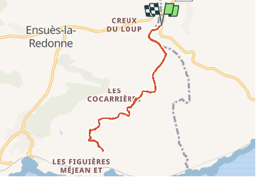

Length
8.7 km

Max alt
229 m

Uphill gradient
169 m
Km-Effort
10.9 km

Min alt
113 m

Downhill gradient
170 m
Boucle
Yes
Creation date :
2020-02-15 13:17:52.0
Updated on :
2020-02-15 15:41:34.72
2h23
Difficulty : Easy

FREE GPS app for hiking
 SityTrail
IGN / Geographical institutes
SityTrail Plus
The world is yours!
About
Trail Walking of 8.7 km to be discovered at Provence-Alpes-Côte d'Azur, Bouches-du-Rhône, Le Rove. This trail is proposed by Klhn.
Description
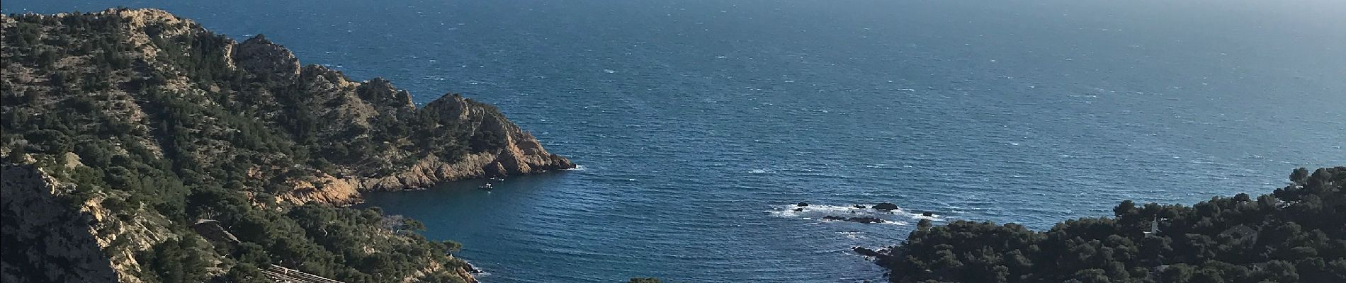
Pour aller voir la mer ...d’en haut :)
Photos

Positioning
Country:
France
Region :
Provence-Alpes-Côte d'Azur
Department/Province :
Bouches-du-Rhône
Municipality :
Le Rove
Location:
Unknown
Start:(Dec)
Start:(UTM)
680748 ; 4802941 (31T) N.
Comments